Route Overview
Stage Breakdown
The Route in Detail.
Stage 01 — Mountain Bike
145 km across highland terrain.
Distance145 km
Ascent3,500+ m
TerrainHighland / Remote
FormatPoint-to-Point
A demanding mountain bike traverse across highland roads, remote tracks and sustained climbing terrain. The stage crosses Hidalgo's mountain systems in a point-to-point format, moving from the start zone toward the canyon entry.
The terrain combines paved and unpaved highland roads, agricultural tracks and remote mountain approaches. Navigation is guided by provided route files. The stage requires consistent output across varied surface types and significant elevation gain.
This stage includes remote sections with limited road access. Athletes must carry sufficient nutrition, hydration and basic mechanical capability to manage minor issues in the field.
Stage 01 — Mountain Bike image
Replace: assets/images/stage-mtb.jpg
Replace: assets/images/stage-mtb.jpg
Stage 02 — Canyon / Trail
The technical core.
Distance30 km
Rappels15 Supervised
Water Entry6 m Controlled
Checkpoints3 Internal
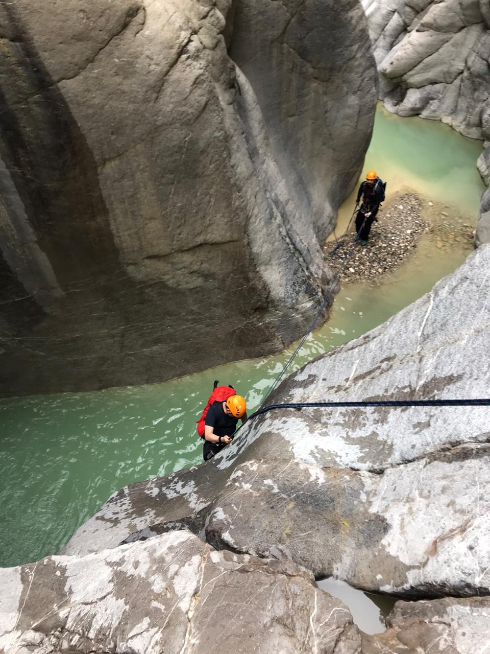
The canyon stage is the most technically demanding section of the traverse. Athletes move through remote canyon terrain using a combination of endurance trail travel and supervised rope sections.
15 supervised rappels are positioned throughout the canyon corridor. Technical staff are stationed at critical sections. Entry to the stage requires mandatory equipment inspection and race control clearance.
Full Canyon Stage Details
Stage 03 — Transition
Mountain to water.
TypeMonitored
ChecksMandatory
AccessRace Control
ExitCleared Athletes
A monitored transition zone at the canyon exit. Athletes complete equipment change, hydration, a mandatory safety check and race control verification before entering the paddle section.
No athlete enters the paddle stage without race control clearance at the transition zone. The transition provides the operational team with an accountability point before the final open-water segment.
Transition zone image
Replace: assets/images/transition.jpg
Replace: assets/images/transition.jpg
Stage 04 — Paddle image
Replace: assets/images/stage-paddle.jpg
Replace: assets/images/stage-paddle.jpg
Stage 04 — Paddle Finish
20 km open water.
Distance20 km
TypeOpen Water
FormatSUP / Kayak
MonitoringWatercraft Support
The final section takes athletes across open water toward the finish line, completing the mountain-to-water traverse. The paddle stage requires consistent sustained effort after 175 km of prior terrain.
Support watercraft are positioned on the water during the paddle stage. Athletes must complete the stage within established cutoff windows. The traverse concludes at the finish line on the far side of the reservoir.